Other videos
10 results found with an empty search
- Why were the winds so strong in this week's wild storm
The intense storm that battered the capital and the South Island this week has certainly left a trail of destruction and disruption across a wide swathe of the country. In a simple sense, a very deep low - for the time of year - passed just south of the country with an active front that extended further. There was also a big high parked northeast of the country, so a very large pressure gradient developed between the two features. Over the distance of around 2800km the pressure changed from 1024hpa at the high centre to around 950hpa at the area of low pressure. The tight pressure gradient at the surface is depicted on weather maps as the zone with plenty of lines very close to each other. The laws of physics say that a set amount of air must exist between each line, or isobar. If they are closer together then parcels of air must speed up to make room for other parcels. This explains some of it, but not all of it. Since the atmosphere is all interconnected, what happens higher up can affect things lower down and vice-versa. The big change that has put our weather into warp-drive over the past week is the extreme contrast of air masses around New Zealand. Late last week a significant surge of warmth high up in the atmosphere spread down from the Indian Ocean into interior Australia. This helped build the big mountain of warm air (high pressure) over the continent. Temperatures climbed into the 40s. This mass of very warm air then spread into the Tasman Sea and towards New Zealand earlier this week. At the same time, the big mass of cold air that resides over Antarctica during the winter, the Polar Vortex, began to destabilise and fade away as longer days and warm air interacted with it. This weakening caused the big solid mass of cold to become wobbly and send surges of cold north. One big lump spread into the Southern Ocean. The interaction of cold air mass and very warm air mass created a significant gradient over the Southern Ocean and Tasman Sea. Warmer seas currently, and long-term planetary warming, adding some fuel to the mix too. The end result has been supercharged weather systems this week - well beyond the typical spring gales. The long weekend will offer a brief reprieve of dryer weather before the next warm-cold interactions give rise to a wet and windy low for the drive home on Monday. Enjoy the sun while it lasts, though the good news is there’s more settled and warmer weather on the cards for the end of October and start of November.
- Winter Outlook 2025 -It could be a wild ride!
WINTER OUTLOOK 2025 – GET READY FOR SOME VARIETY IN THE WEATHER This Winter could bring a bit of everything on to our plate. It will be like grabbing the extra big plate at the smorgasbord to get a sample of everything from the buffet. This Winter’s weather will feature lots of variety from the risk of heavy extreme rainfall, to Antarctic cold and some fine settled days in between. This Winter will feature quite a bit of variety because of no set driving force to the Winter’s weather. This Winter we will have lots of other factors which will jostle for space on our weather maps each week. The main driver that can influence our weather ENSO – El Nino Southern Oscillation has now tilted back to the middle of the scale. Mid way between the La Nina of last year and El Nino at Neutral. In a meteorological sense that means the Pacific Ocean instead of being too warm or too cold is just in the middle. So, in other words instead of a predominant El Nino westerly push with the winds across New Zealand or more easterlies in a La Nina we could have both if not other directions this Winter too. The big pink elephant in the room leading into the Winter is the warmer than normal seas around New Zealand and many of the surrounding areas that help produce our weather systems. They are currently running 1-4C above normal. Our warming planet has been making this quite commonplace these days. Think of warmer seas like that hotter tub of bath water with rising steam – it has more rising air, because of the warmer water which can lead to more vertical motion to help create clouds and weather systems. The warmer than normal seas will act as a bit of extra fuel for incoming weather systems this Winter, but the mix of the coming Winter Weather systems could be quite interesting too. The extreme rainfall events of Nelson and Taree, NSW, Australia are very recent memories but a very good reminder of the stacked deck of cards that the weather now throws our way during heavy rain events. Not just the warm seas but the more significant feed of juicy air from the tropics and the right conditions for low pressure development quite often play a part in these rainfall events. More extreme rainfall events could not be out of the realm of possibilities again over the coming Winter. The Winter weather will have a mix of different types of weather during the season so the extra thick Merino as well as the sunglasses and thinner layers will come in handy. Of course, the raincoats will be a big go to at times too. Overall, the Winter will be warmer than normal thanks to the surrounding seas but that won’t completely keep the cold winter outbreaks air from making a visit at time too. This will especially be the case when a lobe of the all too familiar Polar Vortex rotates into the Southern Ocean. Brrr! The skiers might find some decent snowfall at time too with the right moisture feed coinciding with these cold surges. So, get ready for Winter It looks like it could a wild ride.
- The Big Atmospheric Block of Autumn 2023
There has been a lot of talk about the stubborn weather pattern that has affected so much of New Zealand during the last week or so. There has also been some colourful meteorological words popping up on some of the media news websites, like “atmospheric river” and “omega block”. However, there is more to all this than meets the eye. We are actually seeing the affects of long term global warming impacting our daily weather and seasonal weather patterns. Let's take a look at this in more detail. At the heart of the stubborn or stuck weather pattern that began the last weekend of April (28th & 29th) was a large anticyclone - an area of high pressure. Having slipped quietly across the country, it then stalled just to the east of the country and created the beginnings of a massive “brick wall” that would cause the weather systems to get stuck rather like a log jam in a raging river. Weather map for May 4th 2023 A surge of cold air from well down in the Southern Ocean raced north across the Chathams and into the mid Pacific. It passed over much warmer than normal seas ( 2-4 C ) above normal).This warmer pool of sea helped to increase the vertical motion within this cold surge. This rising air soon developed some spin thanks to planetary pressure forces - ie, Coriolis, etc) and formed a rapidly deepening area of low pressure. With such intense forward motion, the deepening low cut off in the upper level steering flow. Think of it like a wave breaking at the beach. This made for a spinning low that was in no hurry to move. Sea surface temperature (SST) anomoly map. Warmer that normal seas in orange and red. The high passing across NZ then encountered this “road block spinning low” further east of NZ and put the breaks on! At the same time a new low was forming up in the sub- tropics to the north of New Zealand and was heading southeast. Ahead of the new sub-tropical low, a good feed of very warm air in the mid levels of the atmosphere was surging towards New Zealand. This warmer air began to feed into the top of the high just east. This in turn was like pouring petrol on a bonfire. Areas of high pressure are essentially like big mountains of warm air. The taller the mountain of warm air, the higher pressure at the surface. Imagine a stack of plates. Holding a stack of three plates is not that heavy to hold, but three hundred - well that is a different story! This is a big mountain of warm air or “upper ridge”. 500 hpa temperature map May 4th 2023 (Warmer air in yellow and orange) The “road block spinning low” created a log jam - this is known as an atmospheric block. When these upper ridges cut off in the upper wind flow to form a big circle in the shape of the greek letter Omega they can also be know as an omega block. How does this all relate to our weather? Our weekend high was about to become a high that would become a mega high 1042hpa in strength. Intense at any time of the year, especially Autumn. This also put NZ into a warm, humid and moist northerly airflow. The initial sub-tropical low brought rain and gales the northern parts of the country by late weekend but that was only the beginning. As more warm air in the mid levels spread into the upper ridge, the high just dug its heels in and refused to move. Rather like a huge rugby prop digging in at the start of a goal line scrum! Quite often, stubborn and persistent atmospheric blocks can bring about extreme weather events because the weather is intensified and made to linger across a particular location for an extended period of time. In NZ many will remember extreme rainfall events such as the Nelson floods and more recently the Auckland floods in the Summer of 2023. They were all enhanced and intensified because of these atmospheric blocks. So how does this all relate to changes in our planet and global warming? In the last several hundred years the planet has increased in temperature (on average) just over 1 degree C. Many people do not realize that in addition to the more rapid warming at the poles, there is a growing mass of warmth across equatorial regions. This is not just at the earth’s surface, in fact there is more warmth further up into the mid and upper levels of the atmosphere. Global mid-level (500 hpa) temperature map 6th May 2023. Equatorial warmth in orange & red. At these levels the seasonal cold surges do not have as much affect on cooling the atmosphere, so the heat just continues to build and expand further north and south. It is this heat that we now see extending further south into regions like Northern Australia, the Coral Sea and the Southwest Pacific. It was indeed, this warmth that was picked up by the developing sub-tropical lows which then spread southeast into the the upper ridge of high pressure. This is now happening more frequently and will continue to do so as the planet warms further in the future.
- Mother Nature's La Niña Hangover!
The warm Summer and our warm and dry Autumn has been largely a result of the persistent La Niña across the Pacific Ocean. This La Niña has been quite unique because instead of fading away during the transition season (Autumn/Spring) it actually strengthened the cold SST ( sea surface temperature) signal across the central Pacific to the coldest levels in a May period since the 1950s! So what is going on? Does Mother Nature have a La Nina Hangover that she just can't seem to shake off. First of all, what is La Niña? Check out my video explainer on La Niña. In a nutshell it is cooler than normal seas across the Eastern Equatorial Pacific. In addition, seas are warmer than normal further West. Trade winds across the equator that blow from East to West are stronger than normal. These subtle changes have a big effect on global weather. I like to think of La Niña as a big high pressure machine that fuel injects passing highs and also causes their tracks around the globe move further South (or North in the Northern Hemisphere) compared to their mean position. So what's the hold-up? Why won't La Niña just fade away? Wave motions in the Pacific Ocean as well as motions in the atmosphere above are keeping the La Niña machine going (for the time being) and it has even lingered longer than some of the seasonal climate models had predicted months ago. The current projections are still a bit mixed - with some models saying the La Niña will fade to neutral (neither La Niña or El Nino) but others are keeping La Niña in place for perhaps another 6 months or so. Another warm Winter for New Zealand ? Yes, quite possibly, especially with the lingering effects of the marine heat wave in the surrounding seas. This warmer than normal air will help to temper any of the Antarctic blasts that head our way in the short term. One thing worth pointing out with the lingering La Niña is to watch out for a few surprises from the Southern Ocean...... The squeeze zone where the bigger anticyclones meet the seasonal depressions from the South can at times bring some active spells of rain, gales and even snow. It can't be warm all the time!
- La Niña - What is it?
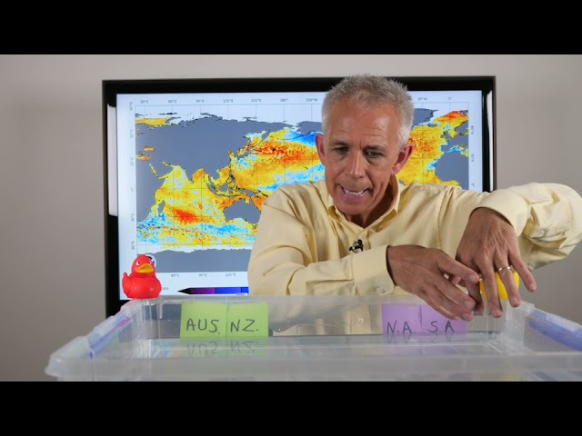
An easy to understand explainer on what it is and how it affects our weather.
- Why is the weather stuck?
This week the weather across New Zealand will be like one of those hurry up and wait moments. That's because the atmosphere is in a giant go-slow. It all starts with the big high that drifted east of New Zealand at the start of the long weekend. It is in no hurry to move. Think of it as a big water buffalo! This week’s unsettled weather pattern will take it's time to go away and changes will be slow to come. So why has the weather been putting on a go-slow with this slow moving blocking high? It has to do with the abundant warm air in the mid-levels of the atmosphere spilling down from it's source region in the tropics north of New Zealand and back westwards to Tropical Australia. Have a look at the 500hpa map for early this week. All the yellow and orange is warmer air. As this warm air (yellow and orange) spreads down from the tropics it engulfs the incoming blob of colder air ( blue and green) from the southern Ocean. It in turn chokes off the approaching front and the low subsequently pin-wheels in place with no where to go. In the breaks between the highs there are wet zones or atmospheric rivers. At the centre of the upper ridges the weather stays dry and settled. At the moment New Zealand is in the wet zone of this flow.
- Cop 26 – What is all about?
You will probably hear the words COP26 quite a lot over the coming weeks. COP 26 is the Conference of Parties to the UN Framework Convention on Climate Change. This forum will hopefully have a major impact on how the global population plans and prepares to tackle climate change in the coming years. This conference is the first time that parties are expected to commit to further reduce carbon emissions since COP21 (Paris Agreement). This is NOW the critical time to come up with a plan of action because most of the recent climate projections (IPCC) have the planet reaching the tipping point within the next 5-8 years. The rapid acceleration of planetary warming, largely due to the” runaway train“ of globalisation has accelerated the temperature rise at a frightening pace. Several years ago the average person believed climate change would happen sometime in the distant future- maybe not even in their lifetime. However, with the recent stream of catastrophic and often unprecedented extreme weather events, everyone needs to understand that those extremes that HAD been forecasted are upon us NOW! As a young man studying for my meteorology degree over 30 years ago I was taught about global warming and it’s impact on our future. Frighteningly, now I see those predicted catastrophes happening in the present day. I have been privileged to have worked and forecasted around the world and in that time I see that the daily weather maps and forecasting criteria have changed and continue to change dramatically as this extreme planetary warming really starts to bite. Sadly the COP26 forum will not be a” flick of the switch” game changer. Even if all the World Leaders were to immediately agree to drastic cuts to carbon emissions, global warming and deadly weather events will still continue in the years to come. Any reductions will take years to see results. Can we look forward to a positive outcome to COP26? The planet’s future and our future depend on it. More importantly, it is essential that the citizens of our planet learn adaptability and ultimately survivability as our planet continues to change in the years to come. Image credit npr.org
- Climate change - a easy way to understand it.
These days you hear the terms Climate change and Global Warming quite a bit in everyday conversation. What do they actually mean? Here is a way to understand it all. Climate change and Global warming can be explained in varying layers of complex language. For most people though it is better to understand what they are and how they will relate to them in the coming months and years. Watch the easy explainer that even the younger audience can understand. More comiong soon... More coming soon...
- A change in the seasons
Some active Spring weather this week with severe gales and heavy rain. There could even be some snow down south. A bit of everything thrown into the weather mixing bowl! Spring can always be full of surprises on the weather front. This is down mainly to the dramatic contrasts in temperatures across the globe over relatively short distances. This temperature contrast produces a gradient, or difference, which in turn leads to wind. There is usally plenty of that to go around during Spring. Check out the video. There is plenty more active Spring weather on the way too! More coming soon... More coming soon..
- More extremes this week across the globe
An active and very wobbly jet stream will help bring about some big extremes in temperature this week. There could be further significant rain to parts of the globe too. More coming soon... More coming soon.. More coming soon...